


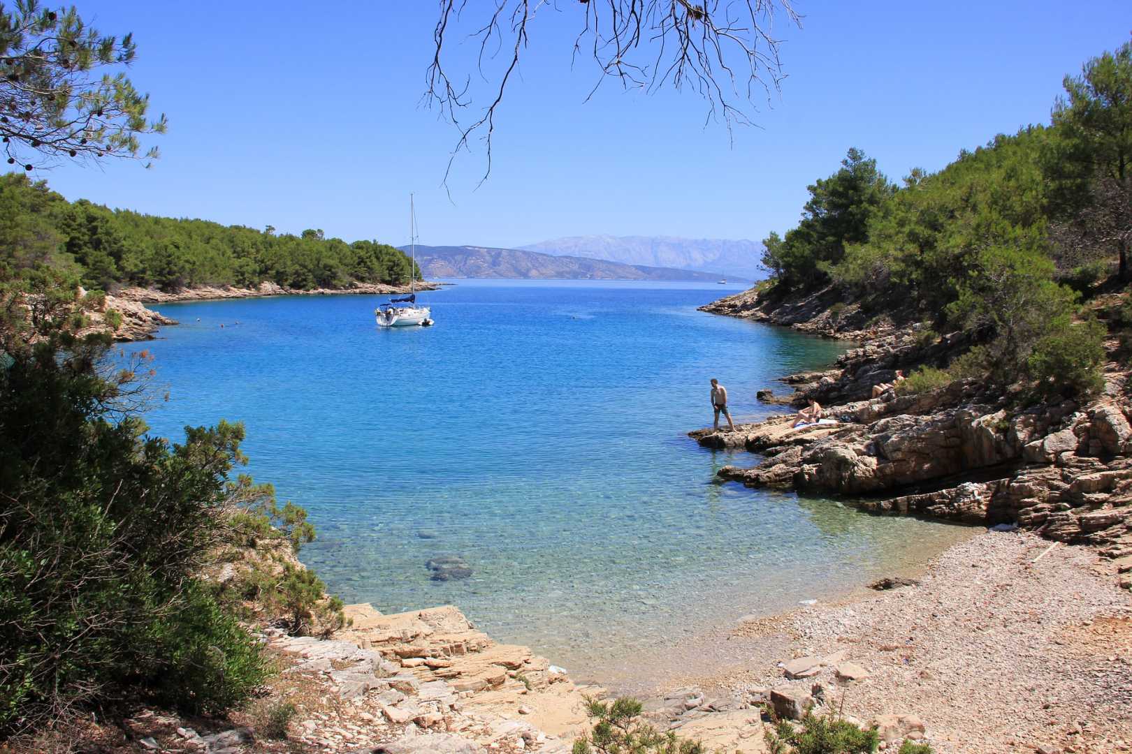
Island Hvar Bays
From the gossip pages to the travel magazines,
HVAR has long been the global media’s
favorite Croatian island, a status it shows no sign of losing.
Hvar ~ Anchorages and bays
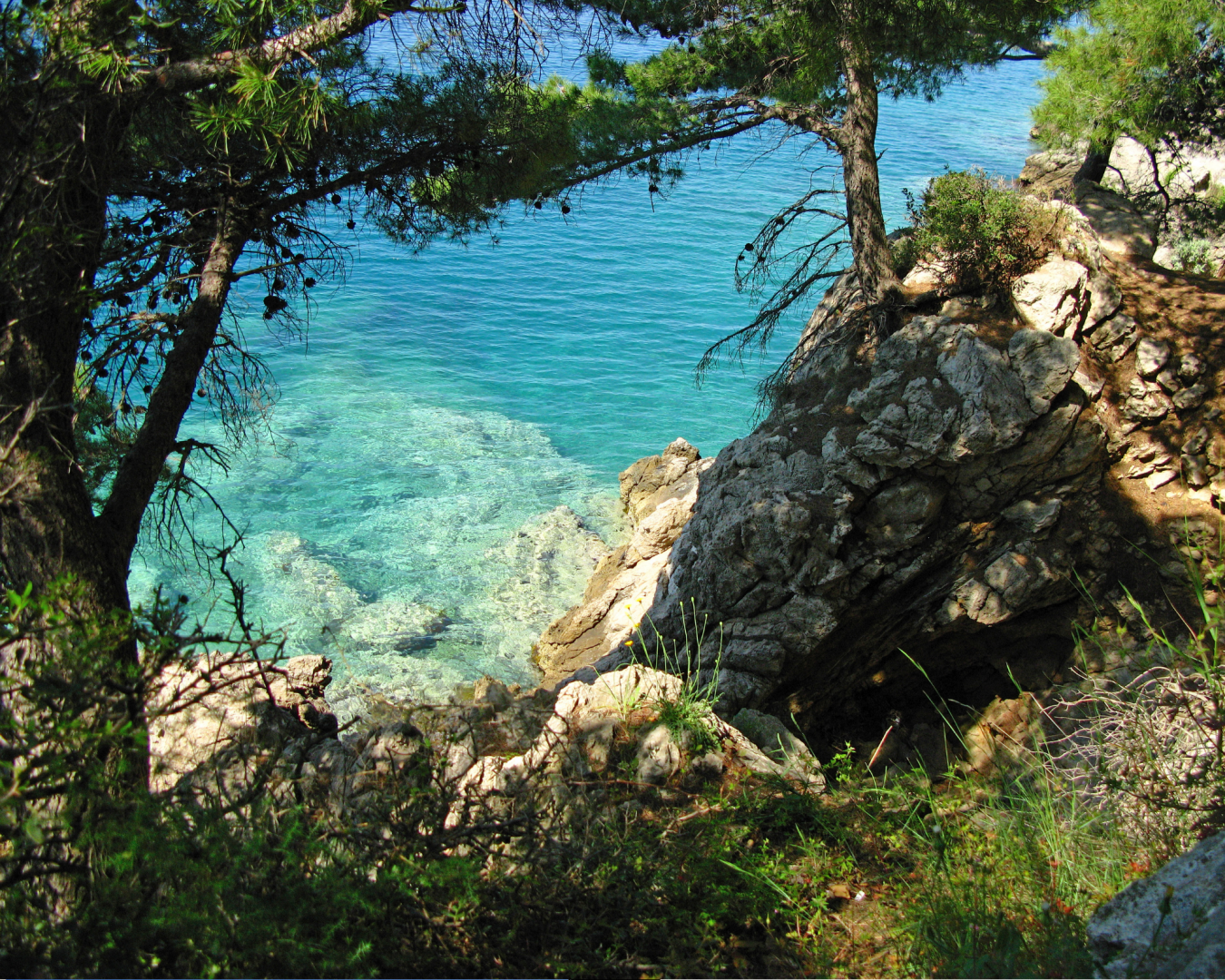
As well as being the summertime haunt of celebrities, yacht - traveler and cocktail sippers of all descriptions, it also remains robustly popular with those who want a piece of the Mediterranean that is family - oriented, unspoiled and affordable. It is well endowed with natural beauty: a slim, purple - grey slice of land punctured by jagged inlets and pebbly coves, with lavender plantations, vineyards and half - abandoned stone villages clinging to its steep central ridge.
Milna is a popular beach resort spread across s two sandy bays, with the main part of the village in the bay. It is difficult to get sufficiently close in to anchor as the beaches are buoyed off and the best option is to pick up one of the restaurant buoys in the bay. The shelter is good except with anything S in the wind.
Duboka 43°N′17, 2.51°E′
Duboka is an undeveloped anchorage offering good shelter in all but S winds. Anchor towards the head of the inlet in depths of 4.0 – 6.0 meters, taking a line ashore given the narrowness of the inlet. The holding is good in sand and weed. No facilities ashore.
Kozja, the next inlet E of U. Doboka, offers good shelter in all but S winds. Anchor at the top of the inlet in 8.0 – 10 meters. Holding is good in sand and mud. There are no facilities ashore. The main anchorages along the N coast of the island from Sucuraj to Stari Grad are as follows
Pokrivenik 43°8.97′N, 16°53.14′E
Pokrivenik is a large bay with several coves where a yacht can find good shelter in all but N and NE winds. Anchor in your choice of the cove in 5.0 – 8.0 meters. The holding is generally good in san d and weed. Some of the coves have restaurants open during the season.
Vela Stiniva 43°9.42′N, 16°48.78′E
U. Vela Stiniva is a U - shaped cove hemmed in by steep cliffs and affording good shelter in all conditions except northerly winds. Its small harbor is invariably filled with local boats, so anchor off in 5.0 – 6.0 meters. The holding is good in sand and weed. There is a stone bollard on the W side of the bay to which it is possible to take a line. Basic café/bar ashore.
Otok Zecevo 43°11.36′N, 16°41.55′E
The small islet of O. Zecevo offers a good anchorage on its S side in settled weather only. Anchor in 4.0 – 5.0 meters. The holding is good in sand and weed. The bay is excellent for swimming but a yacht should not risk an overnight stay unless the forecast is very settled. No facilities ashore.
Maslinica 43°11.41′N, 16°40.5′E
The anchorage of U. Maslinica is just half a mile W of Otok Zecevo and offers better protection for an overnight stay. Note that shoal patches are extending off the headlands on both sides of the entrance. Anchor at the head of the inlet in 6.0 – 8.0 meters, with a line ashore if preferred. Holding is good in sand and weed. The shelter is good in all but N and NE winds. No facilities ashore.
U. Basina is a triple - branched inlet that offers good shelter in one or other of its branches from all but NE winds. Note that the coasts both N and S of the inlet have shoals extending over 200 meters offshore. The northernmost branch of the inlet is the most developed and offers the best shelter, whereas the other two branches are more deserted. Anchor in 5.0 – 6.0 meters wherever convenient. The holding is good in sand and weed. No facilities ashore.
The anchorage of U. Zukova has good shelter from all but N and NE winds. There are several coves around its shores where a yacht can anchor in 5.0 – 8.0 meters, taking a line ashore if desired. Holding is good in sand and weed. No facilities ashore.
Luka Vlaska 43°13.56′N, 16°32.8′E
Luka Vlaska is a long inlet, still largely undeveloped, with several coves where a yacht can find good shelter in all but NW winds. Anchor in 4.0 – 6.0 meters wherever there is space. Holding is good in sand and weed. There is a fish farm on the W side of the inlet. No facilities ashore.
U. Glavna offers good shelter in all but N and NW winds and is largely undeveloped. Anchor at the head of the inlet in 6.0 – 8.0 meters, taking a line ashore if possible to bollards on either side. Holding is good in sand and weed, but poor in shingle right at the head. No facilities ashore.
Luka Tiha 43°12.91′N, 16°33.27′E
Luka Tiha is a large and popular anchorage on the N side of the entrance to Starogradski Zaljev, the gulf at the head of which lies the harbor of Stari Grad . The shelter is good in all but SW and S winds. Note that there is a dangerous rock about 200 meters off the headland on the W side of the entrance. Anchor in one of the numerous branches, depending on wind direction. Depths for anchoring are mostly 8.0 – 12.0 meters unless you go close in and take a line ashore. Holding is good in sand and weed. No facilities ashore.
Luka Zavala 43°12.02′N, 16°34.32′E
The anchorage of Luka Zavala is a mile NW of Stari Grad and offers good shelter at the head of the inlet in all but SW winds. Anchor in 8.0 – 10.0 meters, with a line ashore if possible because of the narrowness of the inlet. Holding is good in sand and weed. Café/bar ashore but no other facilities. The main anchorages along the N and W coasts of the island from Stari Grad to Hvar Town are as follows
U. Parja lies just over a mile E of Rt Pelegrin, the headland at the extreme W tip of Hvar Island. It offers good shelter in all but N and NE winds. Note that there is a dangerous reef extending for around 200 meters off the headland on the W side of the entrance. The two heads of the inlet are occupied by local boats and moorings, but it is possible to anchor in 6.0 – 8.0 meters out side the moorings and take a line ashore. The holding is good in sand and weed. No facilities ashore.
Vela Garska 43°11.0′N, 16°24.49′E
U. Vela Garska i s a quiet anchorage on the N side of the approaches to Hvar Town offering good shelter in all but S winds. Depths are substantial, but it is possible to tuck into one of the three coves at the head of the inlet in 8.0 – 1.0 meters and take a line ashore. Holding is good in sand and weed. No facilities ashore.
Mala Garska 43°10.672′N, 16°25.37′E
U. Mala Garska is a busy anchorage about a mile NW of Hvar Town and offers good shelter in all but W and SW winds. Anchor in 6.0 – 8.0 meters clear of the numerous moorings in the bay. Holding is good in sand and weed. Large hotel and café/bar ashore.